
Topographische USA-Karten
San Rafael Reef
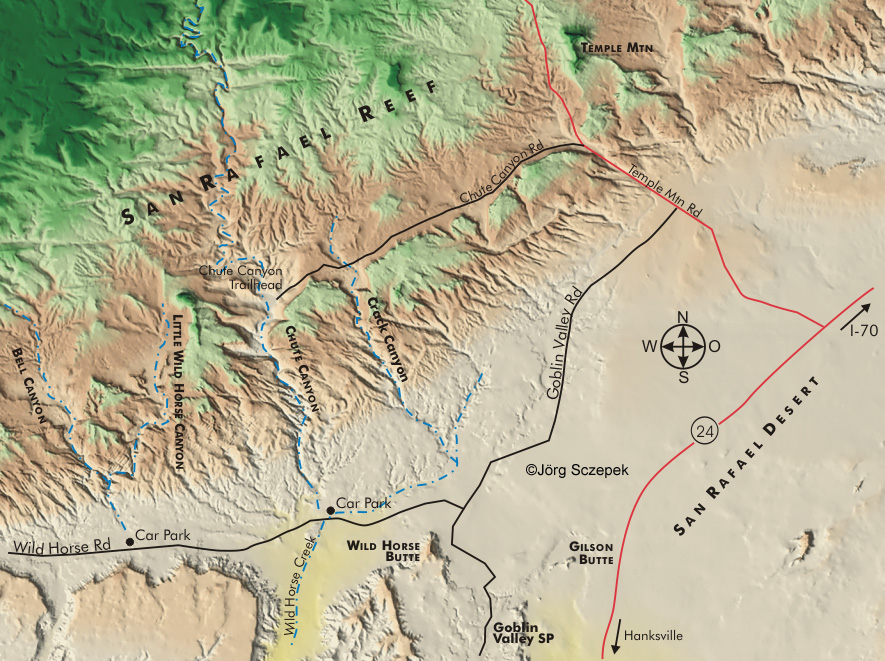
Topographische Karte des San Rafael Reef in Utah basierend auf digtalen Geländemodellen (.dem) des United States Geological Survey.
Index aller USA-Karten.
Topographic map of San Rafael Reef in Utah based on the digital elevation model (.dem) of the United States Geological Survey.
Index of all USA maps.
Nützliche Phototipps und Motivhinweise zum San Rafael Reef finden Sie im
PhotoFührer USA Südutah.
PhotoFührer USA Südutah.